Year 7 Geography Project.
10th May 2021
In Geography Year 7, we have been exploring the different ways we could show what the relief of an area looked like.
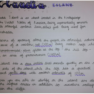
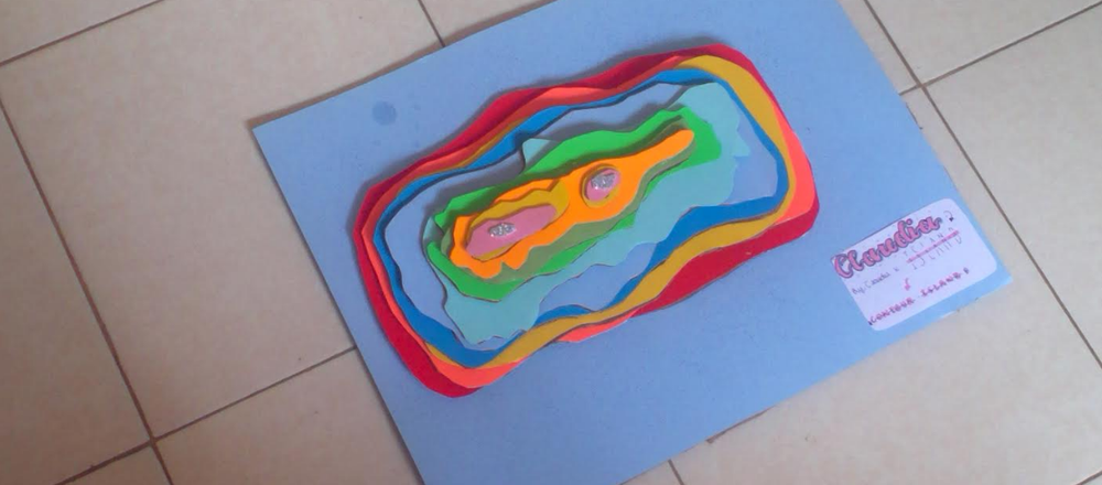
This comes after a whole term of map skill development using our Zombie Apocalypse booklets where we learnt about types of maps. As a build up to this topic, students looked learnt about Ordnance Survey maps, which use imaginary lines called contours to join places of the same altitude. To make it more interesting, most students chose to use contoured coloured cardboard and other recycled materials around the house to represent hill shading. Students wrote a brief write up describing some of the features they included on their contour islands as shown on the samples.
Some students drew the actual contours on potatoes (huh...🤨), yes, potatoes!
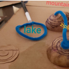
Students have already begun applying this knowledge in their SWOT type analysis of settlement sites, with the key aim being choosing the best possible site to live on with their tribe as seen below. They have then undertaken research on actual settlement sites to discover why they chose to locate there. Well done Year 7’s for your hard work!